Denali
Written and photos by Rodney Tan
Edited by Conrad Slee and Phillip Calais
The expedition really started at Talkeetna as we made our way to the Kahiltna airstrip where we loaded the masses of gear, approximately 70 kg per person including group gear, into a small plane. Before the flight we visited the cemetery nearby to pay respect to the fallen climbers of Denali. As we sat tight during the flight, it took us up past the tundra and then skilfully close to the sharp ridge mountainsides of the imposing and seemingly never ending Alaska Range. It was magnificent scenery and we landed at base camp on Kahiltna Glacier at 2200 metres altitude on our June day. The visibility was poor when we landed and we were totally unaware of the surroundings.
After we set up camp, we were treated to an unusual shower of slushy rain, which rarely happens in Denali. All the gear became wet and heavy and we had to retreat to the cook tent to make the necessary modification to rucksacks, sleds and harnesses that are required to climbing and moving safely on such big and notorious glaciers, which we would soon experience over the next three weeks. Overnight the slushy rain turned into solid ice and was weighing our tents down heavily. The relatively warm temperature of the previous day had disappeared and we were really feeling the cold dry air, which meant we were going to move. But, as we were going to find out, this previous weather had a lasting effect on Kahiltna Glacier. Today we were going to attempt to negotiate the glacier and move up to 2400m, Camp 1, located at the North East Fork Junction.
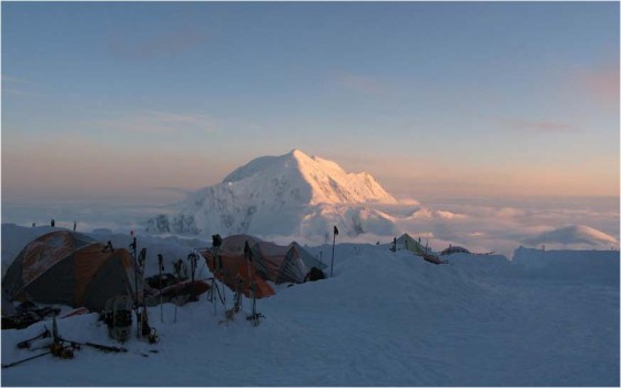
For our first full day on the glacier the normal aim would be to carry a cache of food, fuel and equipment to Camp 1, at the North East Junction, then return to Base Camp. However, not wanting to get stuck at Base Camp, and wanting to take advantage of the colder weather (colder the better for glacier travel), we packed up everything and ‘single carried’ towards our second camp below Ski Hills at 3430m. The route initially drops down Heart Break Hill, aptly named I imagine for those tired climbers returning from the standard West Buttress attempt, who face one final uphill push. But as we were attempting to traverse and finishing off at Wonder Lake, we set off looking forward to our own, never to experience that particular ‘heart break’, or so we thought.
We set off in three rope teams of four (i.e. 12 climbers in total) and after about three hours of moving across the glacier in white-out conditions, the air cleared and, despite our heavy loads, most of us were doing well. One climber however was already struggling badly and after some consultation with the guides it was decided that his trip would have to come to a sad end! As the climber would have to head back to camp, for safety reasons, an entire rope team of four climbers needed to accompany him back. I volunteered to join the team as I was feeling good and thought that I needed that extra training.
After we said our farewell to the retiring climber, we left base camp for the second time to catch up to the other teams at Camp 1. It wasn’t long before we saw some large holes in some of the ice bridges en-route, but we made good progress and arrived at Camp 1 understandably knackered after an extra 13 km on a single carry day. As we arrived we quickly learned that this was not the same fate for the other rope teams who had pushed on to Camp 1 earlier. They had experienced two big crevasse falls, one which took an hour and a half to get the climber out. Thankfully no one was hurt. Eventful but a small taste of things to come.
The second day we carried a load towards Camp 2 at 3430 m. The Hill to the head of Kahiltna Glacier, but we actually cached at Kahiltna Pass and returned back to Camp 1. This is ‘expedition’ style as it involves ‘climb high, sleep low’ approach and it is part of the process of acclimatisation. The only disadvantage is that you would have probably climbed the mountain three times in distance-wise when once you finally reach the summit. The weather at Camp 1, although cold, had not really been too bad but on the carry up we definitely noticed that we were moving into a different layer of weather on the mountain, as visibility dropped and winds picked up. We saw a small bird that had been blown up the mountain and flew around us aimlessly in the white-out only to drop down and die in the bitter cold. Tragic. Life is harsh.
Day three saw us move camp. Although the loads were lighter in our packs due to caching the previous day and some being on our sleds, it felt just as hard as a normal carry day as we had to take down camp and then put up camp again on arrival. The move today was still a tough one though, as a storm was brewing and when we reached Camp 2, the storm was peaking and wind was ferocious.
The storm that had greeted us on our arrival to Camp 2 had subsided by the morning of day four, and comparative warmth in out tents has been replaced with a cold but calm camp. We easily retrieved the cache from below Camp 2 for this active rest day.
The objective of day five was to set ourselves up for a light move day by carrying a heavy load up to just past Windy Corner (4030m). Before reaching this notorious place, the plateau itself provided us with a taste of things to come. I got my first sign of altitude sickness here: slight nausea with a light headache. This is normal for me as I know from previous expeditions on Kilimanjaro, Aconcagua and Elbrus, 4000m to 4500m mark is the most delicate stage for me. While we rested on the plateau, I took off my left mitten to reach into my pocket to get an energy bar and a gust of wind blew the mitten away and, as luck would have it, this was into the direction of one of the other climbers 15 metres away. My expedition would have been over if I had lost that left mitten as I surely would have gotten frostbite without it. We cached around Windy Corner and were quick to move into a safe area as a climber was killed here last season when a big chunk of rock landed on him.
The following day (six) was a beautifully clear and my altitude sickness had gone. In fact it was pretty hot, particularly when we got moving. The extremes in temperature on Denali are just that – two extremes, obviously incredibly cold most of the time, but on occasions also really hot, particularly when moving up- wards, carrying loads and in the sun. It seems climbers have to spend most of their time trying to react to the changing weather and temperatures than actually being appropriately dressed.
We packed Camp 2 and moved increasingly slowly to Camp 3 at 4340 metres at the base of the Headwall. This is a big established Camp with a feeling of community due to the number of climbers here all waiting for a weather window. This camp has a permanent ranger settlement during the climbing season to mount rescues and other missions, not to mention that it is the main springboard for summit attempts. The site is on a huge plateau and is on sage ground. Although the village of tents and the community makes it feel safe, it is at 4340 metres which on Denali feels higher due to a lower barometric pressure caused by a thinner troposphere at the ‘latitudes’.
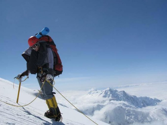
The start of the second week on the mountain saw us go back down to Windy Corner to retrieve our supplies but some of the team were starting to feel the effects of altitude and needed a rest day. Drinking at least three litres of fluids during the night helps to reduce the symptoms. The temperature got down to minus 33°C.
We cached again just below Washburn’s Thumb at 4950 metres, where the Traverse starts to stand out as a much tougher expedition than the standard West Buttress attempt. The loads carried from now on are considerably heavier than any other parties on the Buttress and we also had sleds, we needed everything to make it up, over and out to Wonder Lake. We lost three climbers from the group on day 10 due to altitude sickness, despite the rest day. It was a bad day for the team taking the number down to eight. On day 11 we were pushed into action up the headwall onto the ridge and towards Camp 4 at 5180m. I struggled at first. It was spectacular with steep fixed rope sections and sharp knifeedged ridges with sheer drops to the glaciers. Ambitious plans were made for day 12 with the psychological relief of reaching Camp 4 where most summit attempts are made from. Hardly anyone, if anyone, had summitted throughout the previous month (May). There was summit fever!
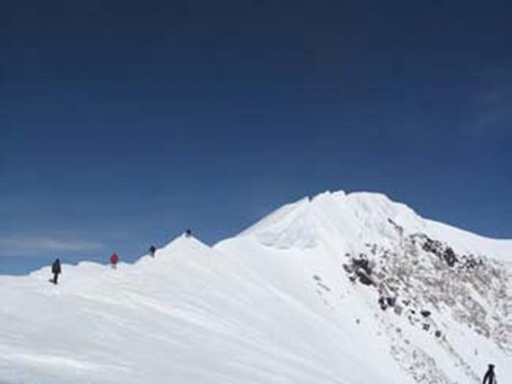
It was ‘traverse or bust’ from now on and the eight of us were totally isolated in finding our own path. We were met by the ferocious winds and temperatures dropped considerably as we crossed to the north side on the Upper Harper Glacier, and big Denali storm was building around us. We were walking on un-trodden, unprobed ground and as conditions rapidly worsened to a full arctic storm, with gusts up to 100 km/h and temperature and wind chill at their lowest yet, we were looking for a place we could make camp quick smart!
We eventually found a safe area just above the Harper Icefall at about 5315 metres and visibility was down to about 10 metres. We probed the area for hidden crevasses and then began to cut out a ledge for us to pitch our three tents. The wind chill was about minus 60°C.
The storm had not eased overnight, and the wind outside was blowing in 80 to 90 km/h gusts. We were not going anywhere on day 14. Everything froze (including sunscreen) that was kept close to us in sleeping bags or down jackets. The storm died a little on day 15, but it did not feel like a summit day. We retrieved gear from our cache and returned to camp. On descent, the conditions worsened and we were again in minus 35°C to minus 40°C and 80 km/h gusts. Visibility was down to 5 metres. My left crampon suddenly gave way as we approached the camp and I fell awkwardly in the hard ice. I was lucky that this happened only 100 metres away from our camp and I hopped to camp with my right crampon. Fortunately it was fixed easily.
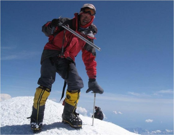
The following morning was greeted with great views and cold beautiful start meaning just one thing, it was ‘Summit Day’. We set off early and pushing up hard to the summit with our light packs of 10 to 15 kg.
From Denali Pass, the route breaks right up a very long but low-angled snow and ice slope, between rock buttresses to Arch Deacons Tower on the edge of the summit plateau. A short descent leads onto the ‘Football Field’, which itself is just below the final couple of obstacles before the summit. It is followed by a steep snow slope around 100 metres high called Pig Hill, intersecting the summit ridge at Kahiltna Horn. There was a final cornice crossing that proved interesting as one of our team members caused the whole cornice to ‘whumff’ and shudder as he moved across it (but thankfully it did not break off and we all made it).
The job was far from done. Our plan was to descend to the 3000 metre camp at Muldrow Glacier in order to avoid getting trapped at a higher camp during big storms. We were confident but it turned out to be an epic with snow conditions under foot starting to break-up and a few crevasse falls around the Harper Icefall punching through the ice bridges up to the waist.
The top of Karsten’s Ridge was a steep and tricky crux. I found myself not keeping the same stride as my other team members due to different a smaller size. I found myself almost running down with a full pack and sled to avoid being dragged along by the faster member in front in deep powdery snow. This was tough with just one trekking axe and carrying a 35 kg pack and having a 15 kg sled. Sections of steep ice became pleasing. The snow suddenly gave way and I took a massive tumble for about 10 metres down the 65 degree slope. I ended up facing down on my stomach with the huge pack on my back and the sled dangling off the pack looking straight down into the void and glacier below some 1000m down! I lay there for a little while being shit scared and wondering how the hell I was going to get up and out of this predicament. I managed with some twisting and turning, taking around 15 minutes to rejoin the team. It was cold in the ‘night’ and we set up camp on the compression zone of the glacier at around 3025 metres, resting the following day while really appreciating just how active and dangerous the Muldrow Glacier really is, as we heard it constantly cracking and popping all around us.
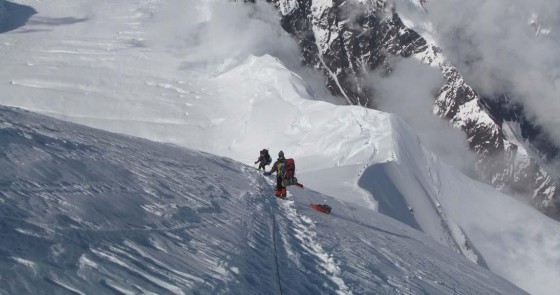
The Muldrow Glacier has been described as a Disneyland of huge crevasses and tricky icefalls. We felt privileged to be where so few people ever go, but as we were about to find out, the day quickly changed from a Disneyland of ice, to a very serious and potentially deadly game. It felt otherworldly as we set off, in and out, up and down, over and around the obstacles. Whiteout conditions ensued and we could smell burning pine from probably forest fires in the distant tundra. We came to a section called the ‘Hill of Cracks’ where crevasses start to run in every direction rather than parallel to each other. Tension was very high. It was too dangerous to set up camp and wait. We had crossed a particular crevasse a few times, and had then fallen through the snow on the other side in a number of directions and about the size of half a football pitch. This meant one of two things: we were either standing on top of a huge pillar of ice, or we had unwittingly found ourselves dangerously and precariously above a giant sinkhole. Our judgement suggested that the ice could not hold our weight. Then all of a sudden, before anyone could react, we all sank instantly. ‘Whuunmmft’ and it echoed all over the valley of ice. It was eerie and scary, like the sound of a huge lightning strike at close range. The whole platform of ice that we stood on dropped at least 20 cm and then came to rest. There was no reason why the platform could not get more unstable. We all turned and ‘ran’ without hesitation back over the original crevasse, with no probing or question of what we were running over. That had just been answered. Phew! At one stage I honestly didn’t see how we would get off the Muldrow Glacier alive.
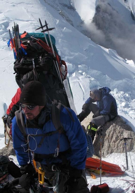
The final two-day push required carrying and dragging our sleds (50 kg to 60 kg per person), over rocks, shale, scree slopes and snow patches. We climbed up and over McGonagall Pass and clumsily down the boulder-ridden other side. This was followed by a 45 km trek over untrodden tundra vegetation with billions of unrelenting mosquitos, a hole in my sled gathering rocks, an icy cold crossing of 20-odd braids of glacial river water to reach our destination of Wonder Lake (640 m) at 2:00 a.m. triumphant after three weeks, having ‘Summited and Traversed’ Denali.

Awesome Rod, well done mate, you lucky bastard 🙂
Well done Rodney. I enjoyed your tale. I summitted Denali in ’92, with one other. We had planned to join a Genet guided group for the traverse, but they chickened out – didn’t even make the summit. We didn’t fancy the traverse as a party of 2 – with no radio.
So reading of your success has sort of finished off that adventure for me.
I climbed a lot in WA, so like to read of what’s happening.